This is typical life, I decided this is it this weekend I’ll finish the article because the week had been very tasking. My househelp knocks my bedroom door, its Sunday 0648hrs. “Carol nataka kuenda off leo na sina fare”- I want to have an off day today and I don’t have bus-fare **insert all the curse words you got for being woken up on your sleep in day and the disorganization in knowing your tasks won’t be achieved** This one even one day after payday wants a salary advance forget her ceremonial off-days and when you ask her to take off days she refuses. That was last weekend. Welcome to our world of Why We Ride.
Why We Ride. Two parents, Two different families, Two bikes, on the road in a January
2020 KTM 390 Adventure and 2016 BMW R1200 GS
Week one had been the week I got home after 0700hrs after a long day and found tones of homework waiting for my help. Friday I left work past 0730hrs, my body ached and ailed, I got home and found a blackout I cheered for I knew the gang would now go to bed and I won’t have to endure staying up because its movie night with the kids. Yippee! If you are a parent and don’t appreciate these moments then you are special.
Journey to Rusinga Island. Meet-up time 0900hrs. Shit I hadn’t fueled, greased the chain nor done bike check as I’d been running errands all week for last minute back to school requirements as my kids schools had opened that week and the coming week it was back to my grind. Home petrol station is out of fuel. Half tank will do to Narok. I do an average 32km per litre on Gisli (KTM 390 adventure) I don’t know how coz manufacturer says 29km. Race to meet up point am 10mins late but it’s fine because Abdi texted he’d be 20mins late 30mins ago. 1038hrs Abdi arrives, another tale of a parent and a household head. If you haven’t yet figured, Why We Ride? It’s a much needed break as a parent to just be. We Ride, It’s a break from the job grinds. Professor still carried his laptop to catch-up on some COB end week report before international time close. As for my students keep interrupting my ride relax music with calls, as they realized they hadn’t met their timeline goals and school opens Monday.
Professor’s confession he wished he was a sea man, He stood there in a trace-like moment. Earlier he had wanted to kayak in the rough lake
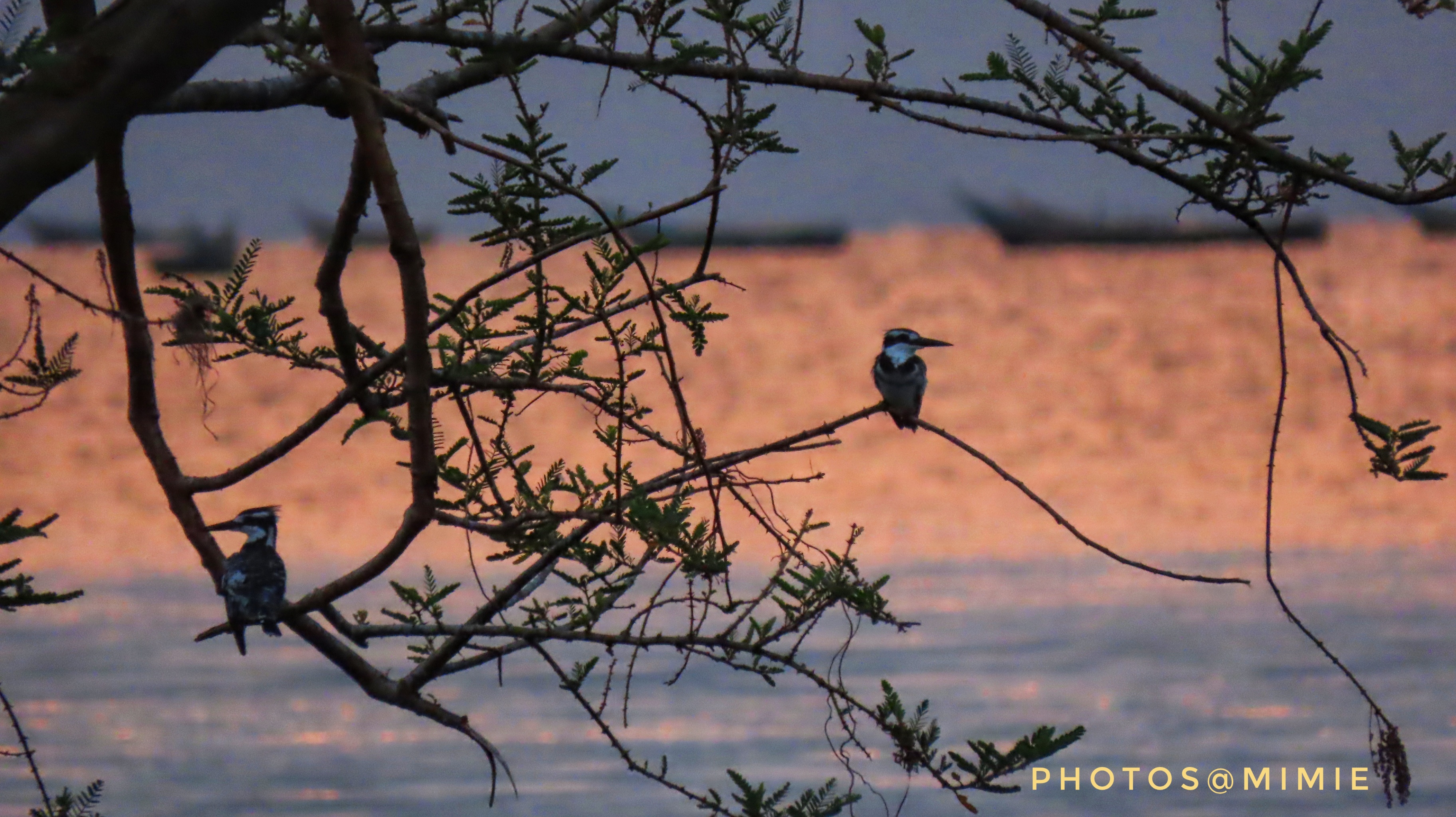
The Sunrise was worth the ride
Lake Sunset
Arrival time after 14KM off-tarmac stretch was about 1830hrs at Rusinga Island Lodge. The craziness along the way, Kisii town. It’s a one-way road with potholes to avoid. That notwithstanding there are very bold Bodaboda riders who are everywhere like the locust invasion with their crazy behavior patterns. One rode up next to me, “Hii pikipiki yako ni pesa ngapi?”- How much is this motorbike. Damn am trying to balance the bike in very slow traffic and avoid hitting the potholes and bodabodas at the same time I almost yell back, shut the fuck up! I keep silent. Then the scary comes over, “Eee ina hata TV!” he yells. This one has a TV, he is referring to the dashboard system. All the while I respond quickly thinking it will make him loss interest fast enough so that he doesn’t ram into me in target fixation. Nope, wrong move. He faces away and announces to everyone,” Huyu ni mama anaendesha!” –It is a woman riding! The bodaboda attention is freaky now, the car behind us now keeps distance as the swarm around me grows. On my dash I see Abdi’s call display as he is wondering where he lost me on a straight line street.
The last rest stop to Mbita Bridge. Women who watched over my behind as I did my business as they fished away and listened to their small radio hang on a tree
A journey of 841km. The traffic police. Same stop I had been stopped when I last used that road March 2020. I don’t know whether dumb questions are part of training and to them all biker ladies are the same as they can’t relate. This time I wasn’t asked to prove am a woman after he recklessly jumped into the road to make sure we obeyed their order to stop. The questions followed, “Naona umerudi…huyu ni nani kwako?…Hii pikipiki ni pesa ngapi? If they are on the road they should at least know how to interpret the various classes on the road license. I had to explain an A2 license is for motorcycle. At Sotik stop we had earlier agreed to move non-stop without the every 100km break (necessary for me not professor) and increase average speed to ensure we arrive before nightfall.
<<—-Sotik water break point
Reception garden area with a HammerKop bird nest on the tree
Rusinga Guide Book
Tom Mboya Mausoleum
TrueFriendship
Around The Island
Rusinga Island Lodge. Beautiful high-end hotel, Serves meals African portion, huge serving! Dinner, I didn’t touch the ugali, the tilapia fish was humongous. Breakfast was again lots and lots, I couldn’t finish even my breakfast, it was drizzling but we decided to go on an island hike to help with digestion. We visited the Tom Mboya Mausoleum. The mausoleum embodies true friendship (when your best friend dies 30years after you and his dying wish is to be buried beside you), loyalty (even The Pope acknowledges the humble, he was the one that joined Tom&Pamela Mboya in Holy matrimony), and patriotism. We had hoped that by the time we got back the rains will have stopped and we do a boat ride to Bird’s Island, waterbirds’ breeding ground. It didn’t happen. In our next plan. See Professor’s write up. So I was gifted a Rusinga Birds Guide Book by the staff, a guidebook is a birding enthusiast best charm gift trust me of course after a binoculars. Am searching looking for a replacement for my binoculars, hint my birthday is next month.
Camping & Tips
Security of camp site. Unless the camp site is fenced and accessible only to you. Take care of your personal effects. Motorbikes draw even more attention so you are likely to lose stuff if you aren’t careful. Do not just opt for a public campsite because it’s cheaper, is it safe? Plan ahead and prepare
Bring extra padding. You need a soft landing after a long day. The other factor is losing body heat to the ground when you sleep.
Drainage system of the campsite in case of downpours. Be slightly inclined. Water won’t pool at your tent
Have a ground sheet for your tent even after clearing the ground of debris. It water-proofs your tent from ground moisture and in case it rains.
Leave No Trace-LNT Principle: pick your trash (Pack it In-Pack it Out), respect other campsite users; loud music, noise is a no no, the pet that becomes nuisance to everyone please please guys left civilization for a reason now you bring in your dog that wakes guys up at 5-6ish and they also disturb the wildlife around the area; respect wildlife and plants do not disturb their habitat or carry them away as souvenir (weee first night we had hippos around our campsite, the fear kept night loo trip to zero)
Check the weather forecast to make sure you pack appropriately, nothing is as miserable as shivering in a tent: warm/light clothes, light/heavy sleeping bag, hot water bottle
Have camp shoes. A pair that is both comfort to walk around with and shower.
Don’t forget lighting: headlamp & a campsite lamp. Solar would be great but carry batteries and extra ones.
A light pre-cooked meal/snack for just in case you get to your location and you are too tired to cook or there is no restaurant around or the downpour won’t allow the comfort of a lengthy meal
Learn how to pitch your tent before the trip. Saves time and minimizes chances of damaging your tent by pitching inappropriately
Bigger tent is better: 2man tent means its comfortable for one person only, 3man tent means two pax, …. You’ll need space for your gear and to move around.
Pack your tent entertainment: a book, earphones to watch a movie, or your kindle, games to share, etc
Power back up plan to charge your devices: phones, Bluetooth headsets, etc. Anyone know where I can buy a solar power bank in Kenya?
Wet wipes saver: no showers or river & lake or ocean to dive into? Cool you can still maintain hygiene especially feet hygiene, groin area (pssst women) and armpits. Even your face will appreciate the freshness that comes after all the road dust. Women we do number two, this personal rule saved me from tick-borne disease one time in Ngorongoro in the evening clean up I found a tick attached to my pubic. Ngorongoro Conservancy Area has both wildlife and livestock co-existing together, so it might have been a buffalo tick.
A tent trash bag. There will be camp sites without litter bins or the back and forth trips to the litter bin.
Clothes: even if you are a minimalist when packing. Just one set of clothes, a sleeping tshirt, pants & socks (I can’t sleep without socks). It will keep your sleeping bag/gear clean & stench free for this is not something one washes after every single use.
The Campsite
Biodiversity
Why we ride? Some ride to cover terrain and distance. Some to absorb every aspect of the journey. The Story of Victoria Nyanza. Luo folklore say that in the distant past there lived a giant called Lolwe. He was so huge that whenever he went outside to urinate, great ponds and pools were formed. One night Lolwe urinated so torrentially that when the people awoke next morning, they found a pool of such vastness that its farthest shores were lost in the mist. That is how Lake Nyanza as known by the locals came to be. Lake Nyanza is Lake Victoria.
Biodiversity. Kenya’s water portion of Lake Victoria is only 6% compared to Tanzania 51% and Uganda 43%, but Kenya’s portion has the highest number of taxa of macroinvertebrates at 62%! As we crossed the Mbita-Rusinga bridge I couldn’t help appreciate its significance in balancing our ecosystem which the causeway had destroyed. So why are macroinvertebrates important? They are a good indicator of water quality showing the cumulative indicator of water pollution. Macroinvertebrates need the shelter and food these habitats provide and tend to congregate in areas that provide the best shelter, the most food, and the most dissolved oxygen. I enjoy the inner child moments just arranging the shells on the beach. In the morning I had done a wade, the water was very clean and tempting though not for long as my mind still remembered I don’t want to be bogged down with more medication if I contracted bilharzia which is rampant in this region.
MacroinvertebratesDutchman’s Pipe-Exotic climber, great butterfly foodPrickly Pear, a childhood favourite fruit Wading moment only far much later I was like sh** schistosomes!No beaches due to the rising water levelsRising water levels uprooting treesHome inventions using locally available resources to make shadeClear waters
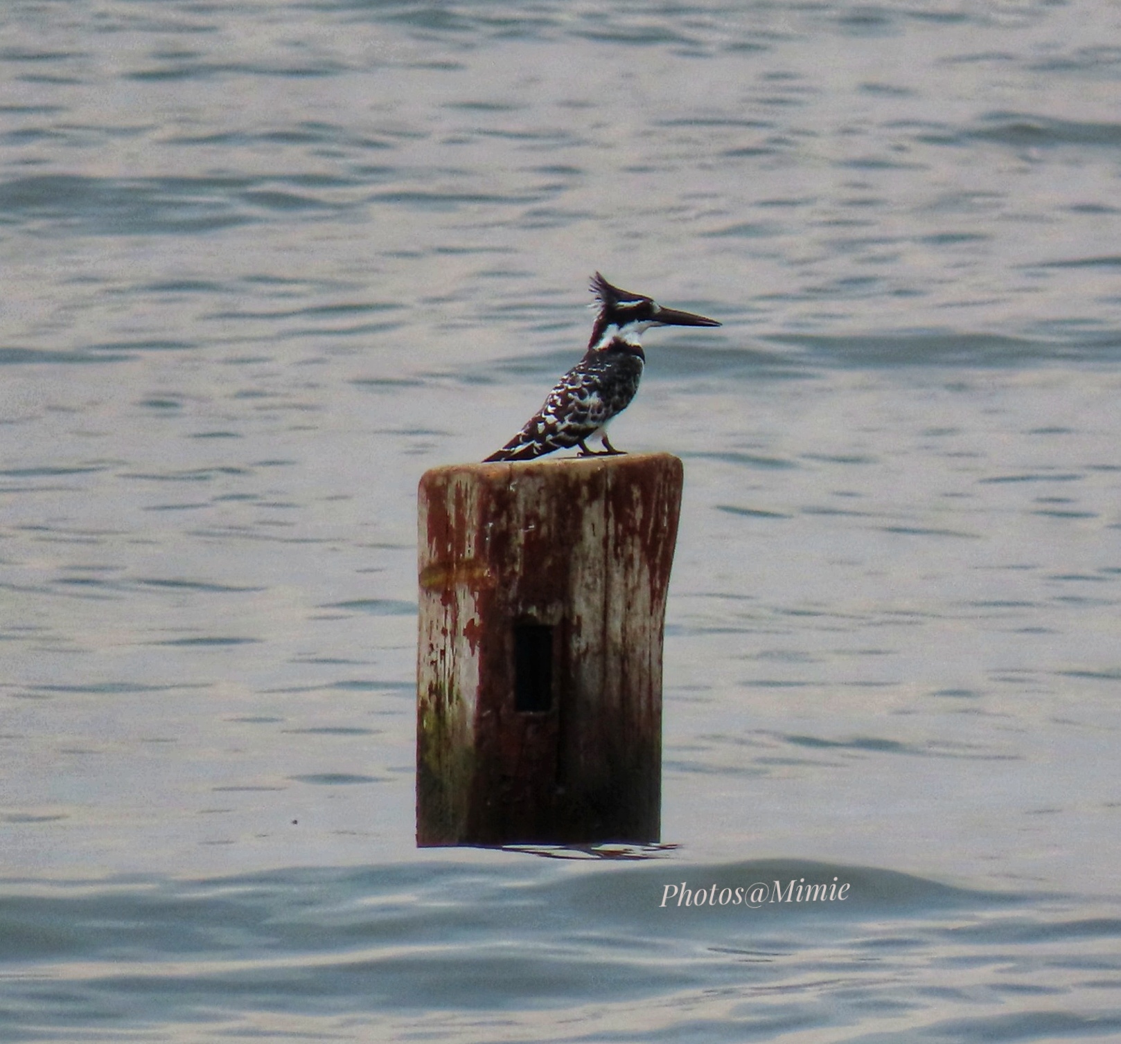
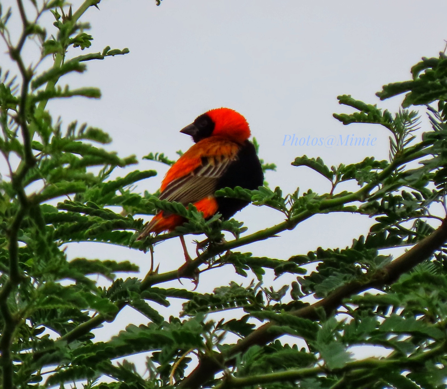
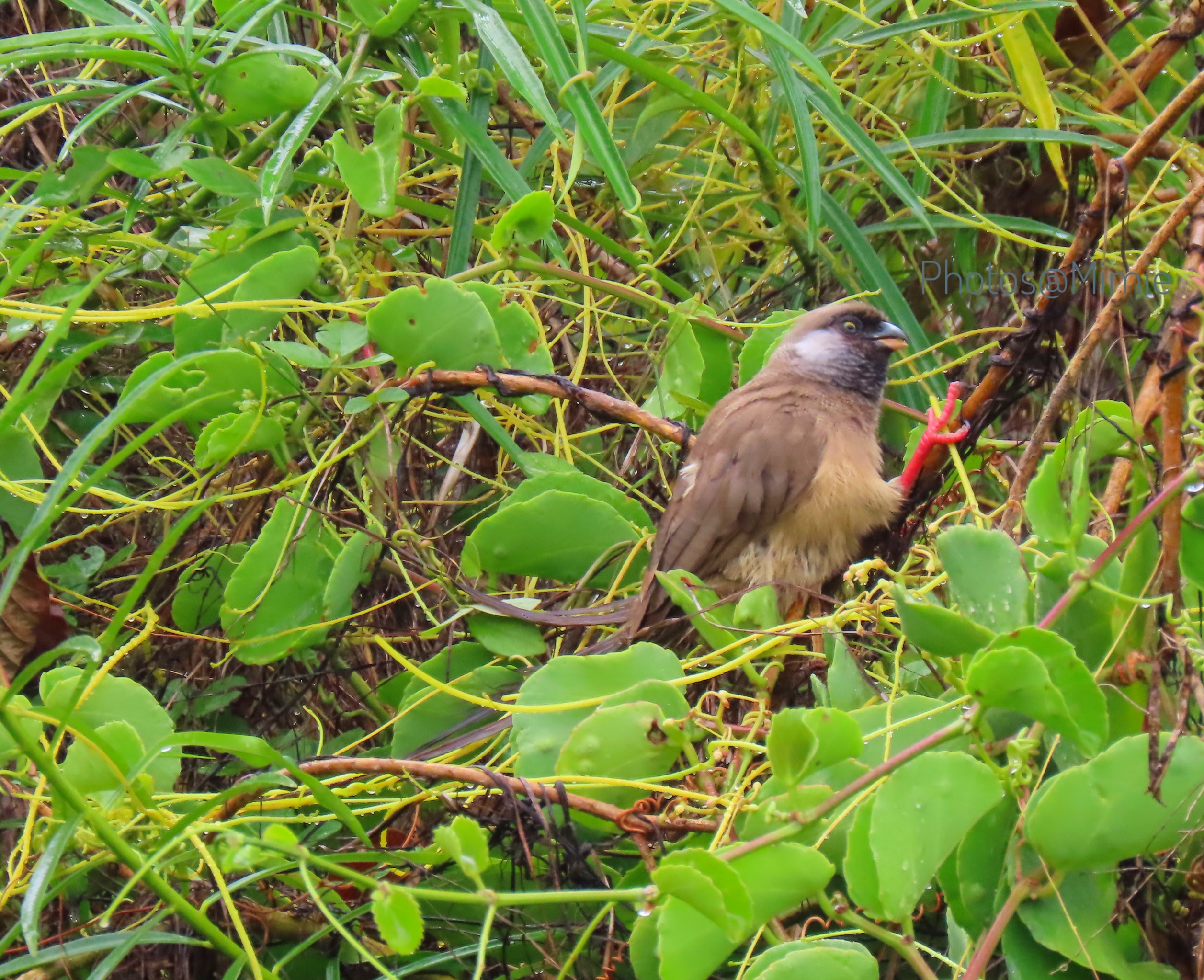
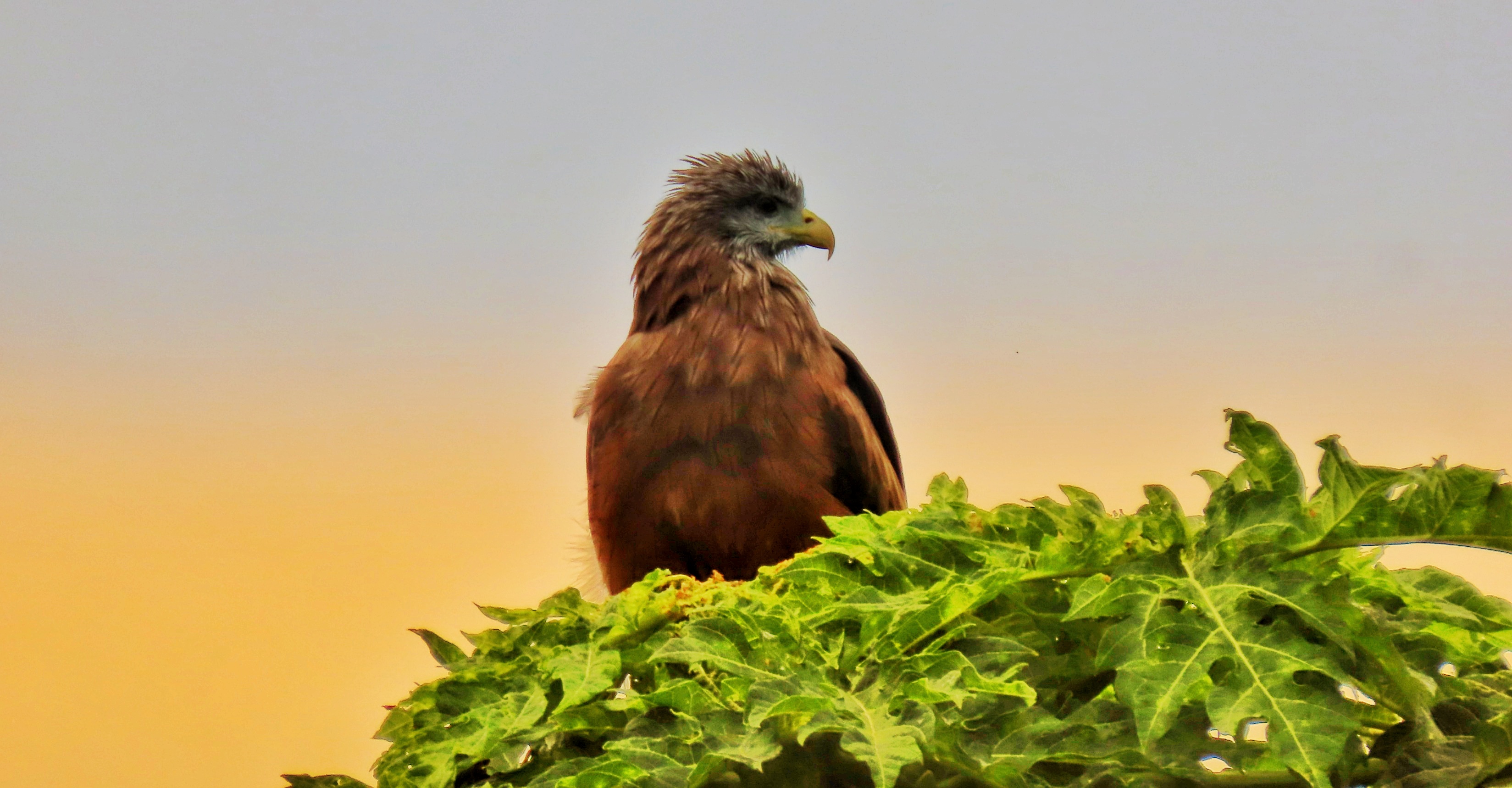
Patient Abdi became ‘the bird charmer’ as I tried to do my thing as we learnt from each other on various topics. Its a gem to ride with someone who has the patience to bird and learn. This trip was a great joy and piece of mind. See the gallery of some of the birds species captured tried capturing in poor lighting with a Canon camera.
If heaven is a sound then it is the sound of nature! Wake up to the the lake roar, the different birds chirping and a hippo across the fence grunting, lets just say it was an orgasmic feeling.
The 0430hrs drama. It had been raining and thunderstorms in the lake all night. Abdi gets a ‘Motorbike-Mud Nightmare’ and wakes us with a start. Well the BMW GS aka the hippo got a dramatic exit again just like the entry, a 3-men effort saved the morning. Rainfall is very important to Lake Victoria as it accounts for 80% of its water recharge as the lakes only provide 20%.
A worthwhile trip
After tales of what happens in the mountains from the meager pay porters are paid, to the altitude illness, Abdi asked me so why do people still go to the mountains after all these? I reversed the question to him, Why do people still ride?
Wilderness holds the answers to questions we have not yet learnt to ask
— Nancy Wynne Newhall.
This is the first post on my new blog. It’s called Take Five in Wild Med as all important information shall be shared in five easy to understand points. Stay tuned for more. Subscribe below to get notified when I post new updates.
It is James Gichuru who fought against this discrimination as their white counterparts wore trousers. Nairobi dwellers know the James Gichuru Road named after Kenya’s First Finance minister. During his tenure he had a blackout moment when he was reading the National Budget in parliament and he had “kutolewa lock” which is to drink another alcoholic drink to rouse one from an alcohol induced stupor. He also missed the State Opening of the country’s Central Bank. Little known is that during Colonial Era he had been intermittently incarcerated next to Gatamaiyu Forest for while being an administrative chief, he was a Mau Mau oath administrator.
Forests in Kenya are classified and managed under three categories. First, the indigenous closed canopy, mangrove and bamboo forests (includes water catchment areas) are gazetted as Forest Reserves which are managed by Forest Department, Kenya Wildlife Services or the National Museums of Kenya on behalf of the government, these are known as Government Forests. No commercial extraction of wood products is allowed except the collection of firewood from windfalls and dead trees by adjacent communities, an example is Gatamaiyu Forest. Second, the Trust Lands held on behalf of the local people by County Governments, or legally held by specific communities, these are Community Forests. For example Karura Forest Trust, Ngare Ndare Forest Reserve and Kakamega Forest. Some harvesting on public plantations of trust forests may be allowed based on calculations of sustainable yield parameters which give ‘presumed allowable cut volume.’ Harvesting above the annual allowable cut leads to overharvesting which necessitates a logging bans. Third, are forests in private ownership holdings like large companies or small landowners under various partnerships or agreements , these are Private Forests. Private forests may usually supply poles and fuelwood for agriculture and industrial uses for example Kakuzi. To preserve private indigenous forest, some land ownership by families or clan, used deathbed curses which were binding commitments with penalties for those who broke them to prohibit actions on land such as tree felling. Example of Indigenous forests with binding commitments is the Nairobi City Park.
Gatamaiyu Forest
Butterflies and more butterflies. Actually one such weekend there was a Uganda based butterfly researcher camping with us. Now looking at my photos collection I took a fair share of butterflies .
Admiral butterflyChief butterflyDotted border ButterflyGiant charades on a dung heapGreen-veined Charaxes
A special place for special beauties. Clockwise Common blue-tailed Damsel, Green-headed sunbird, White-stared robin and yellow-bellied waxbill.
Forest destruction, I am informed they completed destroying this Abbott’s Starlings breeding area. Sad is an understatement. Abbott’s Starling species are endangered.
Downstream the sorry state of one of the eight permanent rivers in Kiambu county was a trickle. Gatamaiyu river and Karura river among others are major catchments for Nairobi River.
River Gatamaiyu that hosts Gatamaiyu Fishing CampMontane wagtail also seemed perplexed at the sorry state of affairs
The moon illuminating a bottle brush tree in Gatamaiyu that night speaks…
Gatamaiyu Forest Area on the southern tip of Aberdare Forest carries a rich history of Kenya. This article gives much details about the Forest as a tourist.
This is what I kept repeating so many times when someone wondered where I’d said I was going. Okay lets start, if you are Kenyan you know the famous Gor Mahia Football Club(FC). Gor was an eminent Luo sorcerer, born in the late eighteenth century, who used the magical and miraculous powers inherited from his grandfather to rule his people. Gor Obunga did not grow up like all children. His father was polygamous as normal in the Luo tribes, but the wife he had Gor from, Atoka, gave him a son and died when he was still a child. One day when Gor was only 5years old, his grandfather summoned all his grandchildren to bless them. When it was Gor’s turn, Ogallo did something different from the rest of them, he gave him his mother’s ash to bury in his hut. This became the origin of Gor’s powers which earned him the nickname “Mahia” meaning supernatural as he surpassed his grandfather’s powers. The boy was also a prophet as he saw “Child-like” creatures so voracious as locusts that he warned the Karungu Warriors not to defend Luo land against them as these creatures could not be fought because they had sticks with them that spat flaming stones. Soon white men would arrive. This man who was a great herbalist, a shapeshifter, a foreseer or prophet would change into a woman or a dog and even pass through walls according to mythology. He died at the age of 126 years in 1920.The burial place has remained a place that attracts not only herbalists, witches, politicians, businessmen, tourists but Kenya’s most famous football team, Gor Mahia FC, still visits his hill before their most important matches, hopefully that even beyond his grave, his formidable powers will score them goals. Lying on the flat floor of the seasonally watered Lambwe River Valley, the park is bordered to the South East by the Kanyamwa Escarpment and to the north by the dramatic volcanic plugs of the Ruri hills. It is on a hill on Kanyamwa Escarpement that Gor Mahia could watch over all people.
Kikuyu culture also have a reference for Lake Victoria…
Approaching a section of the hills that surround Lambwe valley
The Journey To through the lens
Kericho tea farmsComing from Sondu road to this junctionKendu Bay stopoverLunch at Kendu bayNight at Ruma River Lodge
Anybody going to the Lake region knows they must eat Lake Victoria tilapia fish, which we did at a road side hotel on the shores of Kendu Bay. What you should add on the to-do list is buy yourself Jaggery local name “Sukari ngutu”. Made from local sugarcane which is grown in that region dotted with many sugar companies. Its health benefits are especially great for anemic people and the vegetarians can also get their Vitamin B12 from a plant source. Other than add it to my various herbal teas I love the punch it adds to my cup of brewed coffee instead of refined sugar.
As we were settling into Ruma River Lodge, fluttering wings caught our attention. A spotted eagle-owl welcomed us to Ruma. In Kenya, owls are killed because of myth that it’s a sign of bad omen. I have only ever seen dead owls ( Barn owls to be precise) so this was my first owl alive which I could see, not only hear. I equated it to great tidings. Please don’t kill owls they are BIRDS not BADS.
Ruma River Lodge is a beautiful pristine place. All night one listens to the flowing river below the cabins and night birds. In the morning as you have your breakfast one can do some birding, don’t assume you shall find the same birds in the park. The hostess was a lovely lady Irene. Point to note is that eat well before getting to the lodge or plan in advance with the lodge about your dinner. Their breakfast is heavy African dishes. Their microwave was not functioning so we had to throw away our snacks though we were still very satisfied from the heavy late lunch.
Park Day
Ruma National Park is only three square kilometers smaller than Nairobi National Park. We were informed at Kamato gate the routes to take as it was rainy season to avoid getting stuck and also most wildlife avoid flooded zones. Vehicle recovery fee inside the park by Kenya Wildlife Service is Kes. 7500/= and you shall have wasted your day because you cannot alight a vehicle inside parks unless at designated sites. The soil in that region is poorly drained black clay soil so it can be “tear-fest” when it rains. I remember the previous day we took a road-less-travelled to get to our hotel and community members came running to the road to see if really there is a vehicle on that road and if we would make it through without getting stuck. Have a powerful, high clearance 4WD vehicle, one will comfortably cross from Kamato to Nyatoto gate and onto the hills of Roan Sanctuary. Try to research over the internet reviews about Ruma National Park, you will find outcries of do not attempt visiting there in the rainy season. Truth be told the roads are trackable not the mental picture created by the internet about the park as there are water canals directing waters in the valley and the few pockets that nature has won one just needs the proper vehicle, skills to get you around and leave at the first sign of approaching rain.
Hello to the Park Headquarters
The signage at the junction from the park headquarter to Kamato gate
It was a beautiful morning at Kamato gate
Warning rain is coming toward you from the hills
I actually took this photo with my phone to show a better display of Lambwe Valley and the hills that surround the park
To get to Roan Sanctuary signage one has to use Nyatoto Gate.
An Impala winked at us, I think it tried to tell us to take a better photo of the Roan signage across the fence. It was the only picture we got of Roan antelope because during the rainy season they move up the hills to get away from marshy ground. We didn’t want to chance getting stuck in black cotton mud in a grassland less trodden so we turned back just in time as the rain began and just in time to catch Waterbucks grazing unbothered by tsetse fly traps that dotted around the valley. I forgot to take a picture of the traps but we were glad to have packed insect repellant which made our trip rewarding.
See how tall the grass is? Reward number one. Tsetse flies welcomed us into the park, they know to look for skin under the trouser and the place where the t-shirt rides up from your back. Tsetse flies transmit African Trypanosomiasis to man and African animal trypanosomiasis (AAT) to livestock and wildlife (common name is Sleeping Sickness to man and Nagana to animals). Another thing are the malaria causing mosquitos. Western region is a malaria endemic area in Kenya and its best to take prophylaxis Malaria medication prior to the trip.
The other reward was birding. Ebird app had yet to update some birds in Ruma region. My colleague kept trying to submit until it was finally accepted the birding list submission. An example is this Eurasian Hobby.
never mind the shadows as it was overcast as the rain gave us a chase
Classified as Afro Palearctic migrant birds as they spend more months in Africa as opposed to Palearctic countries. Another case in mind is the Eurasian Bee-eater.
Eurasian bee-eaterLittle Bee-eater, I was there too. Can you spot the difference?
The Kenya National Park is also the only protected area in Kenya where the globally threatened Montane Blue swallow, a scarce intra-African migrant. A Montane Blue swallow depend on moist grassland for both feeding and roosting, so they arrive in Kenya from their breeding grounds in Southern Tanzania around April and depart again in September. It was by pure luck that I spotted one in November, a seasoned photographer will tell you that trying to get a camera focus of a specific object in a grassy area is very hard. Welcoming to birding photography. Is this another climate change phenomenon? The Kikuyu prophecy by Mugo wa Kabiru has a bird reference name to the lake, Sea Of Sparrows.
The other bird unique to Ruma National Park I kept kicking myself at being unable to quickly take a photo was the Blue-headed Coucal. Oh well, that’s why we visit places more than once…
My lifer for the trip, Bare-faced Go-away bird
I get it! I get it! Before you say aargggh another photo of Giraffes, they are so many giraffes every where in Kenya, all you need to do just go to Nairobi National park or drive along Nairobi-Naivasha highway. What you don’t know is that a giraffe is not just a giraffe it is like a visitor that comes to Kenya saying everybody is a Kikuyu because that’s all they know about Kenya or Nairobi is the capital of Africa. Only nine out of over 60 Kenya National Parks and Game Reserves have the Nubian Giraffe. The Nubian giraffe (formally known as Rothschild’s) is found in Ruma National Park. The Nubian Giraffe is classified as endangered species by Kenya Wildlife Services with populations of Nubian giraffe – approximately 609, Reticulated giraffe – about 15,524, and Maasai giraffe – approximately 12,717. Check out the unique prints of a Ruma National Park Rothschild and a very unique Maasai giraffe I captured on October 3rd 2021 in Nairobi National park. Even among the species the prints are as unique as finger prints, what I don’t know is if this is an Albino Maasai giraffe as I have not edited that photo at all, it looked like its prints were black and white.
Masaai Giraffe in Nairobi National ParkThe Nubian Giraffes in Ruma
I have to conclude this report otherwise I can go on and on, leaving no room for you to self explore Ruma National Park. Other wildlife have a special place so I’ll leave but a few here
The fire above our neighbour’s house before my mind comprehended that I was actually watching a Moon-rise
Earlier I thought our neighbour’s house was on fire
The story of a rare seasonal moon hence the name ‘Blue Moon’ next to be encountered year 2023. It was a partly cloudy evening so it was impossible to see the planets Saturn and Jupiter close by. However one could trace that directly opposite the sun was setting. The moon is not blue.
I was out soaking in the sunset. The clouds obscured the sunset but the the views were beautiful as always
A nearby communication tower
A clear view of Ngong Hills
The sunset behind those clouds
We can be too busy in life and we forget to take in the healing power that nature gives us for free. The energy of the sun and moon work. It was not all cold gloomy and cloudy for the later part of this month…
Bush sunrise 20-8-2021. Waking up early
How to tap into Mother Nature in your everyday moments
It not that one has to travel, its making the time to reset yourself. Signs and symptoms you need to hit the reset button: feeling a lack of creativity, feeling sluggish, feeling anxious, stressed and easily irritable, feeling lost and in need of an inner connection.
Simple things that are within reach:
Take deliberate coffee/lunch break. Sit under a tree, office balcony and just watch a bird, a butterfly, the clouds as they float by, how the tree is just swaying as the sun causes various colour shades on its leaves -try to be still for a few minutes and note how it feels
An evening walk around your neighbourhood better when you have green spaces
Make a bird bath or trough on your balcony or compound
Got a clean grass patch nearby? remove your shoes take a walk, sit on the grass shoes off or just lay down stretched out. Who cares if they think you are crazy for taking care of you
Get a potted plant or plant some seeds or shots in a pot and watch them as they grow on your desk
Park your car/ bike by the road and just watch a sunrise or sunset.
When working in an indoor space I found breaks just staring at nature screensavers on my laptop really helped to soothe nerves. One time I just zoned out of an endless meeting and just stared at my laptop and just like that I had reset myself. Remember to open a window and let the breeze just hit your skin
Take photos they bring cheer to you and others
He sat peeing at me as I had breakfast, African Paradise Flycatcher
Evening walk, I look up and this Augur Buzzard was trying to hide
That day I had a terrible migraine, after class I couldnt sleep. One of my students took me for a bush walk when we had bushes breaking. The culprit at the fence feeding away
The nights are very chilly. One night I wouldnt sleep so I listened to the song of the Grey-Crowned Cranes roosting for the night “Wiu Hau? Wiu Hau?”
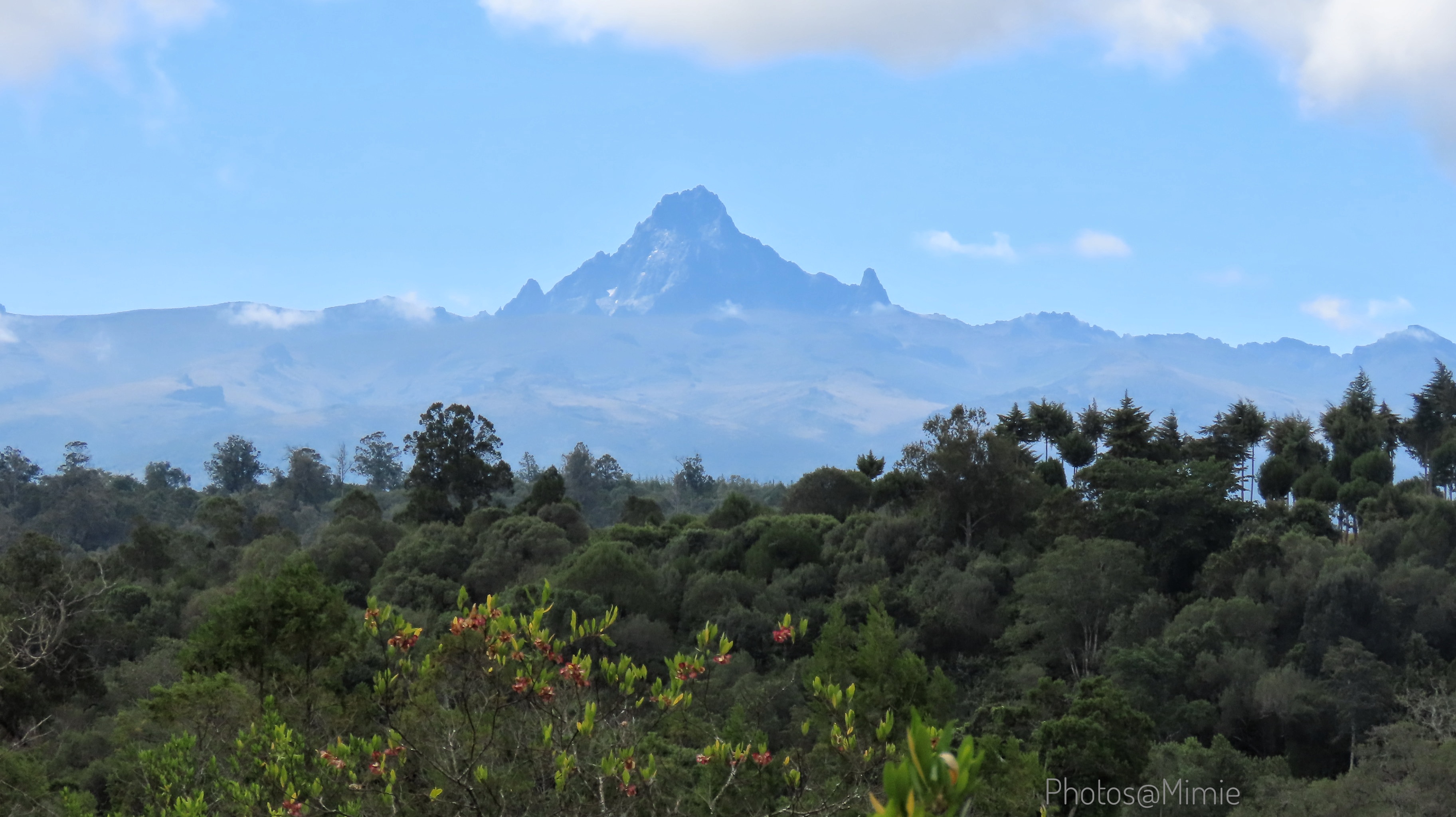
I love the gold of early morning, Mt.Kenya on fire by the sun
Evening tea I watch a Hildebrandt’s Francolin oblivious of the dog close-by
Sunrise the choir members leave for the nearby rivers
The choir members-Grey Crowned Cranes coming home at sunset
Dinner while watching the moon’s journey
Reflection time by a river
Hi, I’m Carol ‘Mimie’, an independent wilderness medic, a medical & outdoor educator and guide who loves nature.
Baboons do not go far from the place of their birth. ~ Masai Proverb
Day bag ready for the hike. The ranger escort Landcruiser was up ahead.
This is a journal of a ride, conservation, hike, tree planting, cultural heritage… simply just be. I cannot answer the how long question either. Why? Enjoy the ride not the chase neither “I was here graffiti”. In awe of enjoying the fish 1000km away and immediately turn around get back and sleep in your bed for the evening, hurray to you! The journey not the destination might take 12hours to cover 100kms in my world.
Mount Kenya World Heritage site includes the Lewa Wildlife Conservancy and Ngare Ndare Forest Reserve (LWC-NNFR).
Mt. Kenya is a was also known as Mwene Nyaga but the little known is that it was also known as Ol-Doinyo Ebor/Oldoinyo Egeré, Kirenia, Ndur Kegnia and Kima ja Kegnia.
The name Kenya is derived from the Akamba word “Kiinya” meaning ‘mountain of the ostrich’ a reference to the Batian & Nelion peaks resemblance to a black-and-white ostrich tail feather. In the Kikuyu Prayer, God is also referred to as MWENE NYAGA- owner of the ostrich.
Taken during one of my hikes
The peaks story we want to believe the mountain is all Kikuyu community. Its supreme authority lies in the Maasai community. Their medicine men, Laibon, most famous was known as Mbatian (Batian)-We have the Batian peak 5,199M which is a technical rock climb. He has 2 sons Sendeyo & Lenana who were like Jacob & Esau wagging war long after their father’s death. Sendeyo defeated, Lenana who died 1911, signed a pact with the colonial government delighting the Maasai reserves. But Sendeyo was still alive in 1926. Neliang (Nelion)-Nelion peak 5188M another technical rock climb, was another of Mbatians son or brother.
On December 3, 1849, the clouds dispersed for a few moments, long enough for the first white man Ludwig Krapf who thought he was being pranked by Kivoi (a Kamba ruler he had met in Rabai, later his companion) saw Mt. Kenya from Kitui.
A 24years old by the name Joseph Thomas sent by the Royal Geographical Society of England had set out on 26th January 1883 from Zanzibar to find the best route in fulfilment of Mugo wa Kibiru prophecy “An Iron snake will be built by the Ciengere from the Sea of Rukanga, iria ria cumbi (Indian Ocean) and it will enter the Sea of the Sparrow, iria ria ihii (Lake Victoria Nyanza). It will not be possible to cut the snake with a machete or spear”. It is reported he was the first white man to set foot on the plains of Africa’s second highest mountain off the route of Lake Baringo, a dash through the plains of Maasai of Laikipia during when there was a great drought.
It was First accomplished in 1893 by J.W. Gregory a Scottish geologist. At noon on September 13th, 1899 Sir Halford Mackinder (we know the Mackinder’s Camp) & Campbell Hausberg reached the summit Batian. Thirty years later, it remained unconquered until Eric E. Shipton & P. Wyn Harris ( Everest fame) in 6th January 1929 @11:15am hitherto conquered Nelion summit via the “Gate of Mist” the gap between the two peaks. We know Shipton Camp point and Lake Harris.
Did you know the name of Snow in kikuyu? Kirera. It was also the name of the white clay that was only gotten on Mt. Kenya for the unmarried Kikuyu men to smear during their traditional ceremonies.
Must Read Book: No Picnic on Mount Kenya by Felice Benuzzi, I got to read it during my training days in NOLS so please don’t ask me for a copy for the last time I checked at text book center it was out of stock.
On the road to Lewa Conservancy with Mt.Kenya in the background
Getting to Narumoru
Route One
Nairobi-Gilgil-Nyahururu- Take the short cut via Solio farm to Narumoru
There is a bit of graded offroad then meet tarmac up ahead. You wont have to go via Nyeri town and its absolutely beautiful! Enroute you get to appreciate the Aberdare mountain ranges on one side of the road and Mt. Kenya on the other opposite side of the road. During your break you can choose to stop at Thomson Falls at a fee and Lake Olbolosat. The traffic is bare minimum and good tarmac a great reward after exiting the madness of Nairobi-Nakuru A1 highway but hey there is an alternative route away from that too:)
Nairobi-Gilgil-Nyahururu- Nyeri-Kiganjo-Narumoru
Feel like you missed out on twisty thrill there is Kiganjo stretch waiting. Keep going till almost Nyeri town past Mweiga. This is another scenic route up ahead but I never took pictures, Lawd the winds! I didnt have extra energy to lift my arms. I got to Nyeri and a friend’s family that hosted me for lunch, the Outdoor Head of Department of Dedan Kimathi University they gave me lots of water to drink since I eat like a bird they complained so that I can have some weight to counter the wind. “Ehe let me tell you Maina!” On the day I took this one, the wind! As tasking as sand/feshfesh but mentally exhausting since there is traffic so deathgrip the handlebar as I swayed side to side when counter steering got difficult. At one point I was foolish enough to gear up & accelerate I literally felt the front wheel sweep from under me and my panic reaction saved me as I hit a gear down slowing down the momentum. By the time I got to Mweiga Kobil Petro Station I didn’t need fuel but my mind told me the extra fuel four (4) liters will help add weight as I rest my hurting arms. I also learnt to weight the pegs in addition to counter steering, keep the speeds under 80kph, less powerful gear though I still swerved on the road. Now taking corners against the force of the wind and the momentum of the bike I think if I concentrated on those high school physics and mathematics classes I would have had a brain on how to conserve energy.
Kiambu-Gatundu-Kangema- South Tetu-Mukurweini(Wajee Nature Park)-PCEA Tumutumu Hospital-Kiangoma Shopping- Narumoru
Begining at Kiambu because Nairobi is not central for everyone just so that you enjoy the peace, the twisties of Gatundu route before connecting with the Thika Superhighway briefly before branching off again to join the Kangema route to more twisties/’nyoka nyoka’ local name. Here I have to admit am not good with this twisties at the end of the trip my mind was a wreck at some point I missed a junction because not everything is on google maps and that lady on google will keep telling you to make a u-turn in a farm. There is a point where one passes near South Tetu girls before Wajee Nature camp but google maps doesn’t have that route. This was my first time using Relive and I still don’t know how to use the features so I cant even share. It avoids the main Nairobi-Nyeri highway just crossing it briefly.
It is here that Gisli(my bike) attained 0-10,000km in our six months love life. No better place than the land of my ancestors as I made stops to where our late grandparents’ home. Wajee Nature Park is the other place, if you love outdoors and conservation there is a whole lot of activities you can do around the camp. The place is also full of history and the owner Jagi Gakunju a great conservationist, its no wander the place is an Important Bird and Biodiversity Area (IBA) recognized Internationally.
Must Read Book: Living On The Edge – Jagi Gakunju, This book is a wealth of history and life on Kikuyu cultures (and others) life precolonial, colonial through independent Kenya, travel journals, family life and conservation. Lets just say its heart wrenching, hilarious, informative, soul searching from a boy’s view to a wise old man passing down knowledge to the young all in one package. Have it in your home library for your generations, I got mine at the Kenya National Museum, Nairobi
This stone house was built by the love of a father for his family to always have a roof over their head should he not return from World War II as he was part of the African corps which composed the King’s African Rifles (KAR)
At my ancestral home farm I get fruits pomegranates which are a rare and expensive commodity in Nairobi markets. I had never seen the aerial yam plant which i was looking at
This is super twisty route, use caution if its your first time! Navigation is still not my strength so I get to use google maps knowing where am headed general direction so I enter map and set locations along the path because if you set by the general geographical name google will give you detours and it also doesn’t know the new roads developments. Point to Remember when you get that point stop and ‘exit navigation’ of that destination otherwise google maps will refer back to as if you missed your destination so your next point will be misdirected. Confirm where you are headed by saying hi to people:) eeeh with caution more so if you are a lady, trust your instincts and use wisdom for your own safety. What was memorable about this route there is a small town I got to just before exiting onto Thika A1 highway and there were drunks sprawled all over the road, all I recall its name began with a letter “G” welcome to my memory world.
It was a day of Kupanda. The interpretation from that Kiswahili word has several meanings. I shall tell you the relavant ones in a few. I set out the journey for my mental health and one thing I always do to find healing is connect with nature and it has never failed and this time facing the mountain of our ancestors for deeper strength in the journey of life. Nurturing is part of continuity, protection and preservation of your heritage. I together with five other friends from Narumoru keen on Conservation were supported by Bantu Mountain Lodge and Kenya Forest Service with seedlings and we planted over 200 indigenous tree on Burguret in a reforestation effort around Mount Kenya. That was the first Kupanda meaning planting trees
Burguret reforestation effort is part of the larger Mt. Kenya system. See Mt. Kenya in the background.
Busy at work
James Kagambi aka KG a Senior Instructor at NOLS. This humble guy is the one that hoisted the Kenya Flag up Batian Peak on Mt.Kenya when Kenya celebrated 50years anniversary since independence in 2013. This year 2021 he was made a Honorary Warden Kenya Wildlife Service-Mountain Conservation
Yours truly busy at work
Kupanda number two meaning. In my community its said never take Ihii Uthoni- Uncircumciced boys don’t attend marriage negotiation ceremonies for their lack of manners will attract penalties. During the tree planting our boy told the father that he did not specify what Kupanda he meant so he went to achieve it.
Kupanda Miti also means climbing trees. Atleast our future generations have some thing they understand:)
The third Kupanda. I set off to Narumoru Gate hoping have a small off trail and day hike. It was my lucky day. As a guide of Mt. Kenya I called up the rescue team and was informed that there was a ranger team going up the mountain that particular moment and they would be my security up the mountain. I rode to Met station. Its tarmac and after that its offroad just up to the communication tower point from there one cant proceed because its marshland so its a hike to Mackinder’s Camp. Five minutes at Met Station it began to drizzle, I aborted any further plans and made turn back to the gate. I did not want to have a slippery affair on the untarmacked section towards Narumoru town. The tarmac stretch is very narrow with almost U-shaped corners(blind bends) and this time its downhill.
Note how narrow the road and the animal signage facing Mt. Kenya
Situation awareness: With speed on the low no more than 30kph, upon entry to the park I turned off my music no distractions. One could spot fresh and smell wild animals droppings along the path despite the eerie silence of the forest except for the birds chirping.
One can choose to get the beautiful accommodation in the Kenya Wildlife Services bandas at the gate. Its economical for a group and self-catering basis. There is also Munyao camp site.
Caretaker happy to be my photographerAt Met Station just before the rain began on the mountainThe KWS Self Catering accommodations on Mt. Kenya
Destination the gate is beautiful until you get to the wildlife and I got carried away. In my foolishness I stopped to take selfies because the buffaloes were ‘far’ and a herd is not as fierce as a lone buffalo. This time I was only using my phone at least I had not turned off my bike and I was near the electric dangles the bull of the herd felt threatened and let out a bellow facing me. Gloves between my legs and phone somewhere between my layers of clothes I took off and only stopped to catch my breath on Tigithi bridge. Return trip number two to the same gate to process ‘replace’ my guide card the buffaloes decided to block my exit. From where I was this time I could not make an exit dash as they were too close to the gate neither could I maneuver a U-turn on the narrow road without attracting their attention so I abandoned Gisli and made stealthy back walk for the gate on foot, the rangers were watching me from were they stood and had already guessed what was happening. I got a ranger escort car to shield me on the side the herd had crossed over to, I was lucky again there was a car at the gate at that time.
Graceful Waterbucks just watched meSelfie modeThe bull that decided enough
Ehe Madam you are back
My My My!
Note how close the herd on the right is close to the road and another on the left still crossing
Buffalo crossing
Slowly dismount, abandon and stealthily walk back to the gate
That completed the Kupanda meaning three. Kupanda Mlima, going up the mountain the highest Gisli and I went was 3188M.
At Tigithi Bridge, Gisli and I let adrenalin settle and contemplated the meaning of life after the buffalo charge. The last time I went past this bridge there was a body retrieval exercise ongoing of a young man who had committed suicide by throwing himself into the river. We were headed for the debrief session of research conducted on Knowledge in pre-hospital emergency and risk management among outdoor adventure practitioners in East Africa afro-alpine mountains, how ironic. Its at this point as I sat there that I made another life changing decision in my life.
The landscapes diversity on this route is so diverse and beautiful that one has to recognize and appreciate its ecological importance to all trying to survive in it. The landscapes created between the Kenyan Highlands and Mount Kenya looming over the flat, arid, grassland and sparse wooded plains creating a scenic afro-alpine flora.
Mount Kenya World Heritage Site includes the Lewa Wildlife Conservancy and Ngare Ndare Forest Reserve (LWC-NNFR) to the north. The two component parts of the property are connected via a wildlife corridor which is part of the buffer zone for the property, and which provides vital connectivity for elephants moving between Mount Kenya and the larger conservation complex of the Somali/Maasai ecosystem. The LWC-NNFR extension incorporates the forested foothills and steep valleys of the lower slopes of Mount Kenya and extends northwards onto the relatively flat, arid, volcanic soils supporting grassland and open woodland communities on the Laikipia plain. As human population continues to grow and climate change factors there is more and more need to protect and provide for all. Hence establishment and maintaince of barrier like elephant corridor (9.8km) as human settlements encroached on corridors which animals used for migration to and from the highland forests to the lowlands connecting these two components. There has been growing discontent between the community and the conservation efforts with the latest conflict causing the community to burn the tourist facilities in Ngare Ndare Forest. When I passed there the rangers informed me that they had just reopened but I don’t know if the facilities have been repaired. On the highland regions/Marania forests I could see evident of trees stripped by the elephants but still met cows gracing on the paths and women walking with farm implements coming from farms which are awarded in the shamba systems. The shamba system of forest plantation allowed farmers to tend tree saplings on state owned forest land (Kenya Forest Service) and in return they were permitted to intercrop food crops until canopy closure.
The road was tarmac just until the Ngare Ndare branch off from there it was a mix of loss rocks, worn out tarmac, wash out road, graded murram, sand, then tarmac highway briefly and again earthen road. There is the google map route, Point to Remember, google maps after you take the road to Meru will take you to MCK Subuiga Methodist Church junction stop there! Reverse and go back to the highway and continue ahead for less than 1km to pass a bridge and a small shopping center then take the next right junction it should be large enough to fit a motor vehicle. The town center starts with a letter “K” I just cant recall the local name. If you fail to stop on realizing that you are at MCK Subuiga Methodist Church you shall know because its a foot path and up ahead you shall find yourself stuck at footbridge made of sticks by the locals to help school children cross over to attend school.
Nanyuki at the Equator MarkerSemi-arid landscapes beginThe broken tarmac stretch at barrier one of NNFRI check my side mirror and I see a beautiful sunset at 1130hrs in the morning and the landscape just amazing. I pack Gisli on the sand. The 390 sidestand is rather too straight, no sooner do i let go of the bike she just slides and my effort to hold her up end up causing him to crash my phone screen which was in my hands at the timeMy saving hands. See the encroaching human settlement on the wildlife reserve component.A break at the LWC gate and chat with John the ranger at the gate as I was contemplating if to ride on till Borana RanchThe elephants in LWCElephants and Plains zebras at a waterhole in LWCBuffaloes just resting and watching the road in LWC. Fenced in:))A Grevy’s Zebra unique to Northern Kenya ecosystem what we don’t have in NairobiThe path that Google Map will lead you into at MCK Subuiga Methodist ChurchThe landscapesRight and left the conservancy in between the community co-exist
Do not disturb any animal. Making noise, flashing lights or making sudden movements to frighten animals is regarded as disturbing it. Animals, if continually harrassed, will avoid human contact or could become aggressive. Never chase animals and keep noise to a minumum. Too much noise disturbs the wildlife and can antagoise other visitors. Give animals right of way. ( I love the KTM 390 Adventure exhaust for one thing when am out there it is silent. Did you know,Riders that ride noisy bikes, especially those without mufflers, often expose themselves to volumes in excess of 95dB. One hour in the ride, hearing is irreversibly damaged)
Where there is an existing road system, do not under any circumstances drive off the road. Vehicles off the road can damage the habitat: oil and fume pollution and plant disruption can seriously affect the ecosystem by altering drainage patterns, soil erosion and pollution.
Do not discard any food stuff or liter. It is dangerous for the animals, disrupting traditional feeding patterns, creating fire hazards and potentially maiming or killing wildlife. (Most of the time we throw out and say this is biodegradable so we throw it out. NO. Out in the Wild its “Pack it in, Pack it Out”)
Please do not stop your car/ motorbike in a position or behave in any way way likely to inconvenience or annoy a fellow visitor. Consideration must be given at all times to the wildlife and other enthusiasts keen to enjoy the same experience.
In the interest of the wildlife and of other visitors there is a limit of 40kph for all vehicles (some parks like mount Kenya specify 30kph). Drive carefully at all times, speeding results in accidents to wildlife as well as degradation of the road surface. Do not sound your horn or play radios or cassettes.
For your own safety please stay in your vehicles at all times-except where a signboard indicates that leaving the car is permissible. Many of Parks & Reserves have designated picnic sites and nature trails.
The animals are wild and can be dangerous. Do not stand up in your vehicle unless you have adequate protection and supervision from a professional driver/guide.
Visitors should only enter or leave the Park at an authorized Park entrance or exit.
Please do not collect any form of fauna or flora from any Park or Reserve. Nor take any animal, dead or alive, from National Parks and Reserves nor feed the animals.
The night was spent at my other home Kenya School of Adventure and Leadership (KESAL) in Marania Forest Reserve part of Mt. Kenya where you shall find Mt.Kenya Rotundu entry route. Rotundu bandas is in the next plan visit as I was informed the last time there was a motor up that route was in January this year and I could tell from how bushy and closed up the road looked and I did not want to take chances to meet up the elephants there while stuck on single forest tracks alone. The place is very cold at night that night it was at 7degrees Celsius and the altitude is 3000M at the cottages level. In as much as am an outdoor person when altitude hits you it doesn’t choose, the local community says, Kirima gutirii jamba” meaning The mountain there are no heroes. I got severe headache that evening and night and was lucky to have carried my emergency medicine pack over and above my usual meds so I sailed it through till I descended the following day. If you ever want to try getting quickly up high altitude without acclimatization remember to take lots and lots of water enroute, it may help reduce the odds. Other than having done a quick ascent I had spent the day in a hot weather ride(sweat=more fluid loss) to get there so those were some of the odds against me.
Mt. Kenya School Of Adventure Base campLast stretch as I hadn’t even had breakfast except for an apple which I was having when an old lady I said hello to informed me I was on a footpath at MCK Methodist Subuiga and she guided me on the correct road. So when I got here I just sat on the pavement right outside the shop to have some sugar there was no cafeteria i had passed in the bush and small towns. Thank heavens i arrived just in time for staff unch at KESAL:) another lucky dayThe final stretch to the gate. Note how the trees have been stripped by the elephants feeding.At the EntranceOur beautiful house for the nightI went exploring the various activitiesPrivate Gun Owners Shooting range under constructionBedside fireplace all through the night and Warrr I needed itScenic route out of MaraniaMore beauty when you enjoy solos you can choose to stop at will and plan yourself accordinglyOne of the many accommodation facilities to suit all budgets on the KESAL grounds. This is a dormitory facilityEven the Merino sheep here are taking no chances, they dress for the weather and would rather struggle to seeDo not be fooled this is not a swimming pool. KESAL trains a lot of military activities too. Its called an Acclimatization Pool. One walks into it at 6am in the morning after the mandatory 0530hours workout using the step you see and stand in the water before walking out again. The water is ice cold but helps prepare your body for what is coming up Mount Kenya during the summit nightsForest camp sites with tent and fireplaceEsther and I debriefing after a long day before the dinner bell sounded off
Day Three
Mau Mau caves hike
The trek began from Bantu Mountain Lodge, however there are other routes to the caves. The marker there says 7km to the caves however Relive app gave me 12KM return trip probably because at some point I hit Flight mode accidentally. One can get the activity organized by Bantu Mountain Lodge at a fee. I had a great guide Kamindo +254723310635.
The Mau Mau caves of Mount Kenya located along Burguret river were used as a hide out by Freedom Fighters under General China regime. One day what was locally known as ‘Ngati’ a community traitor who was also a disguised as freedom fighter leaked information to the colonialist to follow Burguret river upto where it disappeared in a huge rock, that was a cave underneath. A bombing operation killed many. The hike is peaceful and reflective, its sad to see activities of trees that have been cut now shrubs and what mostly make up the forest cover. If Felice Benuzzi was to resurrect and decide to redo his trip up Mount Kenya like Ted Simon did Dreaming of Jupiter on his motorcycle he wouldn’t even recognize where he was. The animal prints and droppings remains you that this is still their territory even as we watched a Verreaux eagle owl we had disturbed from its slumber scamper for safety. I had hoped to finally see the Green Ibis but did not. So on we walked reminding each of the local names and uses of some plants and their unique nature.
The main cave from water fallConnectThe bridge connecting one side of the cave to the other, the side that was the bedroom from the meeting/kitchen sideThe bedroom side of the cave was concealed by these climbersAerial view of the cave, the gap that was left after the rock was bombed offTree stumpShrubs path, evidently very few big tree still existDeforestationAerial viewElephant dung along the path with what looks like hare droppings tooBuffalo dung with its footprint smileLet go, Live!An elephant salt lick hole see the tusks marks left behind
I should accept I am aging the cold weather chills to the bone and the warmth in the room I look forward to despite it nagging at the back of my head I need to plant more trees for this one. Bantu Mountain Lodge
Wildlife of Mt. Kenya Circuit
Take as many photos as you can along the journey as they may be the only evidence you will have of what was. For example, we see and hear much effort in the elephants and rhino populations declining and needing conservation but before we know it the majestic giraffe will be no more as its now in the Vulnerable IUCN Red List status among the wild mangoes, barley and oats species. Elephants population in Kenya as per KWS data 2019 doubled to 34,800 (please am not saying not to keep up the conservation effort, by all means necessary keep doing so) while that I can trace for Kenya giraffe is a population of 21,100 dated 2016.
Primates of Mt.Kenya
Mt. Kenya Sykes monkey is the most colourful in the family is is also interchangeably known as Blue monkeyColobus monkey they are very shy but I call them matharao monkeys getting photos was a three days affair then finally then appear just before nightfall near my roomFeeding Olive baboonWhen grooming gets too sweet
Vegetation of Mt. Kenya
Get a translator to the local ‘french’ language to understand the uses and botanical names:)) It is good to learn the local culture of a place in order to appreciate the traditional importance of something. At another level please scientific names is not my strength am happy to use common names and local names. Which reminds me the other day I bought the guidebook ‘Wild Flowers of Kenya & Northern Tanzania by Anne Powys’ because I could had misplaced my ‘Wayside Flowers of East Africa by Teresa Sepieha,’ when I got home I felt like walking back to the bookshop it’s all Scientific names man even though the photos are all very clear!
Mwenu ‘Candle bush tree’ used in kikuyu to wash mithirimo if you have bara gotten after sitting too long at the fireplace or for cows when they have Digania (cow constipation) by boiling the leavesMutero treeMutongu tree and fruit loved by monkeys and elephantsBeauty of flowers Senecio i think, am terrible naming plantsCape Chest nut tree hosting a stranglers fig that will later consume itThistleA pencil cider tree strangled by the stranglers fig tree
This page is still work in progress, I want to dedicate it to our future generations who may or may not find the wildlife here-in, to the online traveler, and to the future traveler. Know that Nairobi was once just a marker, Mile 327 on the Uganda Railway, “It was plagued by disease, rats and lions” as reported by old narratives.
The greatest threat to nature is not poaching anymore. In the name of urbanization and the economy we are destroying everything nature. The Nairobi National Park and the surrounding wildlife dispersal area have faced serious challenges which has seen recordable decline in wildlife and the introduction of invasive plants species.
“We do not Inherit the earth from our ancestors,
We borrow it from our children”
Native American Proverb
This is a photo album by the amateur photographer in me, the quality will speak louder, during visits. The park has more to offer that is why I say work in progress. I consult the more experienced guides very often especially on birds because we all learn everyday, we also forget or just might miss out a detail that distinguishes one from another.
For the purpose of being systematic I shall use broad classification. I begin the blog with Birds.
BIRDS
Small as the park is and suffocated all round by human developments, the avifauna is diverse, with a remarkable 516 species recorded hence an Important Bird Area(IBA).
Martial Eagle guarding its prey as a Gabar Goshawk is in a branch underneath waiting
Martial Eagle with Sacred Ibis as its prey at Hyena Dam
Black-crowned Night–Herons very shy and hard to find. One has to know where they are found in Nairobi National Park and even then one is very luck to get a clear shots.
Black-headed Heron after a drinkBlack-headed Heron in the grasslandsBlack-headed Heron after a meal. Note the bloody bill
Now there is this, the never ending changes in bird names. Keeping up is tasking and expensive. Guide books are not cheap, unlearning is not easy too. Teaching an old dog new trick. The lapwing or is it plovers.
Five Stocks:))Immature/ Baby Yellow-billed StorkAdult Yellow-billed StorkAfrican Open-billed storkThe undertaker, Marabou StorkSaddle-billed Stork. During a toilet break I happened to have carried the camera. I spotted something I was not quite sure what i was seeing as it was far and very sunny
I have been lucky to have a super great one, he is also a Patrol Volunteer for the Nairobi National Park (NNP) for many years. I think even blind folded he would find his way around not only NNP but this region. Mr. Jagi Gakunju of Wajee Nature Park has mentored many of us. Every time together in the park there is always an eagle waiting so still for us.
Another important lesson on birding I learnt from my friend who is a Tour Bird guide, Conquest Adventures. Keep every photo counts, Do not delete it because you think the pose is not as you would have liked it or it appeared hazzy and probably it was the only shot you got before it flew away. Why? It might be the only evidence you might have that that bird was in that habitat, behaviour pattern, distribution or location of a bird thought never here! Again from those shots you capture from various angles will give you broader details into the bird like a facial disc, a flank colour, etc.
Now here is one am still arguing out that its a Hunter’s sunbird but its distribution location cancels it out and colours are iridescent. A Scarlet-chested sunbird it is.
This one hides and hides but I still managed a shot. However there is a beautiful pic of it I took in Rusinga Island. Find it here
White-browed Coucal
Share your knowledge. It is your way to achieve immortality.
Dalai Lama
Next edition is hidden by the Masaai ostrich…
Bonus
In order for an ecosystem to thrive and sustain wildlife populations and rich biodiversity, wildlife need a dispersal area. The animals move back and forth from the NNP during wet and dry seasons. This allows for vegetation regrowth, healthy nutrition, and calving. One such area is the Naretunoi on the Athi-Kapiti plains where community volunteers through The Wildlife Foundation have been conducting animal counts same day as the NNP counts to show the importance of maintaining a balance around National Parks. This is the difference and importance between a park and a zoo in which animals are fenced in as proposed in the KWS ten year Strategic plan.
A wildlife dispersal area in Naretunoi from the Nairobi National Park. In the background are lights from Grain Bulk storage silos
The unfenced NNP southern side conservationist have set up Lion-light projects to keep away lions from homesteads, leased out community land in an exchange where the host community get payments twice an year, timed out with academic calender when schools open to enable the community afford school fees for their children as majority depend on livestock hearding which have been co-existing with the wildlife.
The flickering small lights in the homestead as the sun sets are the Lion Lights
Community rangers work to help track and monitor the wildlife populations especially in reducing human-wildlife conflict. The community sensitization efforts have greatly paid off in that now KWS is called in to help in safe wildlife removal from human settlements as opposed to earlier where they were being killed off.
August 8th, 2021 was the one year anniversary by The Wildlife Foundation (TWF) wildlife counts in collaboration with KWS. I was part of the community volunteers that helped make this effort a success to help support the future of our biodiversity.
Photo credits to TWF Counts team of August 8th, 2021
Click here for more information on The Wildlife Foundation efforts. Some of the weekend’s highlights in pics.
The Naretunoi dispersal area is divided into eight blocks which are managed by community rangers. Pic of team assigned block two ready to set off.
It was an interesting count. The data sheets account for Birds, Mammals, and Reptiles. Both electronic and manual data collection systems were in use. In general because it was a dry season, the wildlife had crossed over back to the NNP side hence few animals counted this month in comparison to June 2021. (Counts are conducted every two months). Sharing some of the sightings in pics.
Ranger scouts as Njeri keys in our data on the phone appThe previous night’s bonfire team was hilarious when in the morning onewould not tell the difference between sugar and salt so…am not naming names brought ‘spiced’ tea as part of her packed breakfast:)))Scout FelixThe senior community ranger Dan was our host and guideLets scout the waterholeWaiting out for the dust-gapOloroi in Maasai is that nose-ring. It’s put on grown calves to stop them from suckling either to wean them off but mostly during the dry season so that the mother maintains good health as grass becomes scarce
Mammals
Bachelor Eastern WildebeestStare-down momentThomson’s Gazalle. I have no idea why its coat is so rough yet its horns dictate its an adultCaption this;)
Till next time
The category not in the counts, Insects. Image Cotton StrainerDebrief session led by Ed Loosli- TWF the Board Chairperson and Marco Pruiksma former FONNAP Chairperson
This is more a story of encouragement and strength to live everyday as much as it’s a motorbiking journey.
“I was neither brave nor strong, so I don’t need brave and strong to do this, I just need determination.” -Ted Simons author of Jupiter Travels finally said after his 4years world journey.I couldn’t have better words for my journey.
Why I Ride? I shall give you my story and how I did it solo, it’s for you to fish what is relevant to you as adult learning is complex.
I am a woman anatomically, I am a super mum (but well the world loves the term single mum more) of four (18yrs, 9yrs & twins 7yrs), professionally I am a pre-hospital medic, a medical instructor and a wilderness/outdoor guide. Health-wise a have a rare form of blood disease which is a myeloproliferative cancer for life and no its not hereditary. It occurs mostly in persons 60years and above, well I am not, but I have a gene mutation that makes my odds flip. Treatment goal is to control the condition rather than cure the condition, which means I am forever on forms of chemotherapy drugs that control blood counts, and blood thinner/ anti-clotting meds (which means I have to watch what I do very carefully as any trauma I could potentially bleed out). Coping with a rare condition can be difficult both practically and emotionally. What does this translate to? I am forever tired so I have to choose wisely how I use my energy and take frequent breaks to avoid deteriorating; bone pains, frequent headaches that are somewhere between a migraine and a piercing headache which can give me ringing ears; then comes the lack of appetite and nausea accompanied by occasional vomiting; sun exposure burns due to sensitive skin, sunscreen, hats are my best friend; periodic memory lapses, let’s just say during my outdoors training I flop navigation skill; socially to live with my mum for the days when am not coping well and days I just want to be.
I love the outdoors so much for in it I get my healing and strength. In truth it translates when I go for the monthly clinics after coming back from the bundus my blood-works are somewhat stable then when I come back to the city especially the pollution that makes me forever nausea we get into an argument with the doctors wanting to increase my dosage to counter. I asked one of the renown hematologists that was taking care of me when I was at my worst what I can do for I love the outdoors too much but this cloud can be too much and he was like well, “Carol just do it, live it, just take care of your limits.”
Why I Ride? I have long since learnt not to share my aspiration especially to those that know me because I shall get ten reasons why I shouldn’t so I just do it. I had been planning this ride in my head for a while and asked the universe to lead me to people that will encourage me and build my skill set. During the research I was told not to venture that route alone because of security. Well, as Dos Throttle Adventures once told me to get a riding partner is as hard as getting a relationship partner. Boy don’t I know that too well. Earlier in the year I went on a ten days ride total 1262 kilometers through 10 counties and let’s just say it nearly got physically ugly when my choice of partner couldn’t accommodate my limitations at one point I was saved by a local who happened to appear from nowhere like an angel. Group rides are also not fair to others so I end up in a group but alone with my own plans. Overcoming the fears.It started when I enrolled to Offroad EA riding school. I told Mike the coach in as much as I need the skills, I don’t have the need to go Enduro and jump over hills all I want it to overcome the fears that come with being on off-tarmac terrains. I got more than I bargained for during the classes, I was told to be having an oats breakfast as that will give me energy throughout the day and that has been the best discovery in my diet routine! The lady coach Grace with a forever smile and constant encouragement kept telling me I can do it even when I got on the bike and no sooner toppled over on the other side for lack of strength and fear when I saw obstacles in the terrain, other trainers to advanced courses have pushed me aside with words that am too basic. The other is music. The never ending debate of riding with music verses no music. Music and motorbiking combined puts my mind at ease helping with the anxiety attacks. Just enough music to calm but hear what is coming from the environment. Seeking Help.For the routes I had never used I sort the help of a safari guide/tour operator Conquest Adventures, I was informed on the general route and even helped to negotiate accommodation to places I thought I would need rest stops, well i didn’t have to use those rest stops for other plans came up. The offroad route I got advice to look for a Martin Mureithi as he was the only biker known to have done that route. He was a blessing given it was one day to the trip, he guided me all through virtually including the timings I had to beat it, reminders to deflate tires, and he panicked when he couldn’t reach me on phone.
Archer’s Post Junction I did a victory dance at the sighting of tarmac. i was so beat and I thought i couldn’t make it to civilization before night fall. The passengers in a Probox headed where i had come from alight to watch me and timely it was listening to “This is Why we Ride 3”
ROUTE & TERRAIN
Total distance: 1,067Km
Total Five days: I had to take two rests.
Day two I had one of those major headaches and chills. Day Four was a short trip of 98kms Archer’s post to Meru and I just had to rest for I was properly fatigued, poor nutrition, no sleep and yellow-red eyes. All that combined with the rain that escorted me I nearly rear-ended a donkey cart carrying nappier grass getting into Meru town in the forested area then when I got into town I almost hit cars as I wouldn’t stop on those incline junctions adequately due to fatigue.
Route: Nairobi-Gilgil-Olkarao-Mweiga-Narumoru through Solio ranch-Nanyuki-Rumuruti past OlPajeta ranch-Suguta-Kisima-Wamba-Archer’s Post-Isiolo-Meru-Embu-Kindaruma Dam-Matuu-Thika-Kiambu
Fuel consumption: 32.87 liters cost will vary according to location in Kenya
Some road barrier after KisimaSuguta-Maralal stretchMeru-Embu road
One of the three equator markers crossed
Terrain: Smooth tarmac through to Mweiga junction, graded murram to Narumoru. Tarmac Narumoru to Nanyuki. Nanyuki-Rumuruti horror to horn your skills for what lay ahead as its loose gravel with rocks on the road 82km took me 3hours. Rumuruti to Suguta few Km of tarmac and murram. Suguta to Archers Post, I think I shall say riding on corrugated iron sheets when not in the sand that was either wet or dry as it had just rained some areas, some rocky climbs and descends and glad that river crossings had concrete pavements. Archers post onwards is tarmac except watch out for livestock, bodabodas without side mirrors in Isiolo and a pillion at the petrol station that decided to use my windshield to dismount, he shall never forget the wrath of a biker and a hungry woman at that. Then google maps lost network and decided to lead me off a red muddy path in Embu as it had rained that night and I had to seek help from a stranger named Joe to turn back around as my bike kept skidding and my boots slipped on the mud when I tried paddling.
Scenery: absolutely beautiful both on-tarmac and off-track. For the wildlife, camels included the mountains and hills, the forest stretches. Just fear grips you at sunset when the mountains begin to cast shadows into the valley and the last stop you meet a kid barely 6years grazing camels who one look at you and trying to converse with him, he runs for cover. As for the camel around the corner that refused to leave my path I just had to remember don’t hoot and pray it just stands there as you ride by less than a meter away and I was glad that this bike doesn’t have a noisy exhaust. Never spook a camel! Bird photography is difficult even on a normal calm environment, now trying it on transit on a motorbike and quickly trying to stop, remove a concealed camera and capture fleeing birds took luck and a broken lens cover. The scenery is both beautiful and scary, the area has history of bandit attacks so pee breaks in the bush were rushed and never managed to completely empty my bladder. The Rift Valley, Aberdares mountain range, Mount Kenya, Ol Lentille, Mathews ranges, Ololokwe rolled on.
The camels, The scenery, but do you notice the direction of the left side mirrors :))
The Bike itself: Gisli is his name, a KTM 390Adv was the model for all the pics. Lucky him! At Rumuruti stretch I skid on the loss gravel in a rut damage to my right was my side mirror became lose and I waited for a passing lorry crew to help lift the bike. Gisli too decided to faint after passing the signage “Slow Down Dangles Ahead” I think passing the elephant barriers had him in stress too, I dismounted to stretch as I contemplated passing herds and herds of huge cattle approaching. I look back and Gisli is like madam pleaseeee let me just lay here and that’s how the other side mirror came lose. I couldn’t tighten them as one my tool kit is under the seat where I had strapped my bag and secondly the function of my right hand is somewhat as I can’t hold the spanner after a thug used a machete on me in a robbery in June last year. So everytime I had to go done a decent or uphill the left mirror would spin and hit my chest or helmet and I had to pray I don’t injure myself. At one point when I got to a small town past Wamba the bus driver exclaimed “alah hii side mirror inataka tujione mbele!”, direct translation, this side mirror wants us to see ourself ahead. The side mirror was facing forward. Standing while riding here would having been the best option but I have learnt to conserve my energy even when I feel strong as it can just plummet abruptly. Well I stood some distances so that my speed would increase and it was a funny affair as I sat on my bag as the bag had slid further ahead from where I had strapped it and I wouldn’t stop to readjust. I learnt that the hard way during my last long ride when I wouldn’t handle a water logged muddy stretch after a long day’s journey and I just fell and sat down in the mud crying and the then riding partner didn’t take it kindly. Here it was a matter of safety and chasing daylight I needed to take all caution.
The short smooth stretch at the Dangles where Gysli decided he was comfortable to faint as he slid off the gravel
ACCOMODATION
I was hosted for two nights in a beautiful home typical of the way mountain cabins look like as its wooden finishing and some brick and the décor is forest like. It belongs to a former NOLS instructor Mungai Njenga and one can get it as an Airbnb. Photos won’t do you justice as they were taken in the haze of pounding headaches.
Archer’s post got a modest accommodation that is the only one that is clean there about. Steto Guest Lodge cost only KES1,000 bed. It is also your only chance of a decent meal on order. Only downside is prepare for the noise if you are downstairs as you will here noisy drivers asking to be opened for the gate from 4am and a next room guest snoring through the night as I tried to sleep in the stuffy atmosphere. I tried another place Northerners for meals and I just gagged trying to eat the ‘firao’ its a shoddy pilau meal as a breakfast. So resolved Meru was just here I can eat there.
Meru a beautiful accommodation at Cam Supreme Studios. Very clean spacious room, well ventilated, TV with connection that works, a room has an extension that looks like they had a kitchenette in mind, hot shower, safe parking with a car wash, Gisli finally had a pampering proper wash here, (after a chain clean in Archer’s post where he was set on a gas cylinder and Omo cleaning detergent and cloth was used the dust off the chain so that I could lube). Carry your own lube always. Digressing, Cam Supreme and has a restaurant section with very delicious meals and their pub session is also awesome. For a new year’s eve, it was the best place to be but I was too beat to do anything but room service and spend the day resting. Wonderful, helpful and friendly staff. Oh and google maps will lose you to get to the exact location. I had to call for final stretch and when I finaly arrived google maps was like am 800metrers away. Ehe now the vocabulary in meru, I called reception to ask if they have OAT porridge for breakfast and I was told yes. Morning I see a thermos and was served, I thought maybe it’s the powder oat flour used. I sit it’s the traditional sour porridge of the Meru, at this point am laughing. I asked the receptionist and she is like you asked for HOT porridge:)) Cost B&B KES.2000/=.
Sitting room lounge back-view, disregard my mess, wooden stairs leading uo
Front-view of lounge
Rustic bed
Mungai served a wholesome dinners
Gisli’s Garage in Narumoru
GIRL TIPS
Men please skip this part if you don’t have a female side.
One time Wamuyu Throttle Adventures asked to recommend fuel stations that are women friendly. Riding when on your periods is not funny and for me it’s the worst time of my health too as it feels as if someone is drawing my strength with a straw. Total-Gilgil was the last place with a clean toilet that had water to clean up after yourself before I got to Narumoru accomodation. Thank heavens I had thought to back up with a liner too. The other was a petrol station before Nyahururu and with no water and the key to the ladies couldn’t be traced I used dirty gents
Next trip days was me & bush. Thank heavens for thigh bags so wet wipes, tissues, and sanitizers came in handy, but stil… At one point for respect of the unknown I parked at the side of the road and asked some women who were cleaning near Sadhana Forest Post if I could use the bushes near them. From there it was till Archer’s post for everything had to be in bush dash. So when I say it’s a wonder I dint get a UTI its real. At the accommodation there too they had no women in mind and when I asked for the sanitary bucket I was told ladies just wrap their business in tissue and just dispose off in your room bin next to your bed. I was like haidhuru si we dispose off condoms the same way!
Nails. Clip them just as you would before going to the mountain this includes even finger nails. The boots all day and gloves will chop and chip your nails. Then for your hygiene where there is no water like in my case.
At Sidhana Forest marker where i asked women for permission to use their bushes as they watch over my ass
NAVIGATION
Best consider Safaricom internet to operate the google maps, airtel is terrible out there. There are patches with no network so the offline map which the lady doesn’t speak to guide you so you have to have a phone mount or make stops often to check direction or ask. Google Maps also has a sense of humor at one of the locations I had set up a school as a route marker so when I passed and proceeded with the journey and at a junction to Wamba the next town google wanted me to make a u-turn and head back to the school saying that school time closes in an hour, haha. Of this white man google maps, the last stretch home was Ngecha road, google lady pronunciation was “N.G.E.C.H.A road.” :)). Martin had told me to put the powerbank in my pocket for the network search would drain my phone battery, thank heavens I listened.
Navigation and culture interaction.At Kisima not so sure of the junction to Wamba because on-going road construction I stop a probox for direction. Inside four men listening to those naughty kikuyu songs and had to lower the volume to hear me, their assumption am Kikuyu even if I addressed them in Swahili they responded by telling me to go to “Githima” and ask as they are also visitors. The place is ‘Kisima’. At Nyahururu I stopped at Thomson falls. The place where 100bob of a bracelet saved my helmet and luggage from a pickpocket who was trying to figure to unhook my helmet from the bike when I caught him and he pretended he was admiring the bike but it was proving tricky to remove it in time due to the location Mahmood Khambiye had once showed us. There was this mum a bodaboda guy directed me to when I asked him where was safe to park, a mama Wanjiku selling curios in a traditional tray was requested to watch over my bike as she was just sitted there as I visited the falls who agreed as long as I promote her sales. I went then came back and asked her where I could eat as we walked along so she could direct the pickpocket saw the opportunity. As Mama Wanjiku was talking on phone telling someone she is at “Kirurumo” is when I turned and caught the thief. ‘Kirurumo’ is the local name for Thomson Falls.
Why I Ride? To give encouragement to everyone with a chronic medical condition and especially cancers where you need supper abilities.
You can do it! Don’t give up hope to the very end. There those that look up to you. I wish I could just afford to do this trips more and still earn a living while at it, Trips of Hope.
Motorcycling is all mental and physically involving one cant afford to just sit and let the machine and environment take care of you. I decided to live it all in my late 30s as I had never even ridden a bicycle in my life. It took Sheer Determination and a Pure Love then one finds all the forces of the universe align for you. This being a lady, alone, little experience protected me from mechanical issues, injuries and kept me safe in it all. A fit of selflessness and passion for life. I did (195km short) half the time I did my other long ride, 5days in all and visited more counties (12).
Why I Ride? I do this for the sheer determination of life!
This year I had the opportunity to eat the damaging locusts that invaded East Africa. Yummy! Well since I cant recall my childhood taste bands baked out of Blueband tins.
Fun fact: Grasshoppers hear with with bellies yes their auditory organs are located on their abdomen.
They are camouflaged in a way that blends with their local habitats.
Female grasshoppers start to lay eggs when they are about 1 to 2 weeks old and will continue to do so at intervals of three to four days until she dies. Grasshoppers live for two months. The eggs will remain underground for about 10 months before they can hatch into nymphs. Well almost like our human pregnancy.
Survival strategy. Then why aren’t there so grasshoppers? Well the largest predator to grasshoppers are various kinds of flies. They lay their eggs in or near the grasshoppers eggs. After the newborn flies hatch they eat the grasshoppers eggs. Some flies wont even stop at that, they lay their eggs on the flying grasshopper’s back. The newborn flies will then eat the grasshopper.
Birds, humans, snakes, are some of their predators.
It is National EMS Week, marked 17th-23rd May 2020. Injury prevention is one of the pillars of Emergency Medical Services. In East Africa, floods have caused misery to several displaced families and deaths in this times. So how can I save myself and others?
Deaths related to floods have claimed more lives in Kenya than Covid-19. According to the latest statstics from the the Ministry of devolution 237 lives have been lost in comparison to 50 lives due to Covid-19.
One cannot downplay the prevelance of fatal and non-fatal drowning of untrained persons attempting to cross flood waters. “Do Not become a statistic” Rescue attempts by untrained persons should be done using the Throw & Reach Method only, do not enter into the hazardous environment.
Throw and Reach: use Rope, Long branches, Flotation devices like jerricans, paddles
Rowing: use a boat or canoe
How Does Drowning Occur?
The Drowning process and what needs to be done to minimize fatality
The body’s initial shock to cold water initiates a gasp reflex, hyperventilation, inability to hold one’s breath and this is where a person can drown if their head is submerged into the water. The heart rate and blood pressure increases also due to the shock.
Cold incapacitation occurs by the loss of basic motor-skills. Locally we say “Nimeganda ama nimekufa ganzi”. The person can’t hold onto rescue aids thrown to him like ropes, jerricans, cannot swim adequately, the extremities stiffen. Drowning can occur here as the person is unable swim.
Hypothermia stage Occurs when the core body temperature falls beyond its level of maintaining core body functions e.g the heart adequately pumping blood. The victim will finally become unconsciousness and drown. Hypothermia begins 30minutes to 1hr after being in the water. If the victim has personal flotation devices that can keep them afloat then they can survive an hour or more in the cold water.
After-rescue Collapse/ circum-rescue collapse happens to a person who was rescued from the water and seemed in a stable condition. The victim experiences fainting or cardiac arrest which leads to death. What is happening here:
Continued drop in core body temperature (this is temperature to the heart, brain, liver & lungs) after removal: Wrap the rescued with warm blankets/ clothes and if possible remove all wet clothing
Sudden drop in blood pressure: All rescue efforts and care after should be done when the victim is in a horizontal position, that is they should be laying down.
Rough handling of the victim for example asking them to walk around to help generate heat. This increases the work of the heart leading to cardiac arrest. Be very gentle when handling the victim during rescue and during care after extrication
Victims in Submerged Vehicles
Remember: In 30seconds-2minutes activate SWOC protocol
SEAT BELTS OFF
WINDOWS OPEN
OUT IMMEDIATELY
CHILDREN FIRST
If the vehicle is stationary stay on-top of its roof. If it is sinking or being swept away swim away from the vehicle
Crossing the Flood Waters
“NEVER CROSS A RIVER IF A CROSSING SITE THAT MATCHES YOUR ABILITY CANNOT BE FOUND, IF IN DOUBT MAKE THE CONSERVATIVE DECISION NOT TO CROSS AND LOOK ELSEWHERE FOR A MORE SUITABLE CROSSING LOCATION”
Prepare for the crossing
Choose crossing area: Straight, wide and shallow water crossing is best. Have a visual of your entry and exit points and any hazards along the path. Test water depth using stick
If possible to remove your lower garments to reduce drag however keeping your shoes on to protect your feet from injury and traction
Unbuckle the waist and chest strap of backpacks, and loosen the shoulder straps in case you have to let them go to save yourself in the event of a fall.
Avoid looking at the river during the crossing as its mesmerizing and inters with balance
Face upstream to cross. This protects your knees from being buckled by the current.
Cross in a diagonal line slightly downstream
Take small low steps one foot at a time, moving slowly and weight the foot carefully in case the foot gives way. Do not cross your feet
If it’s a group crossing have pre-planned communication signals
Wading Techniques
Solo: Get a long branch walking stick as support and position if diagonally in-front of you to help break the current with it sank into the river floor. Only shift your support walking stick once your feet are stable on the river floor
The Group Pole: This can be done effectively for a group of 2-6 people. Done with either the team facing upstream or across the river.
The Chain Technique: Use for numbers of inexperienced people and is done in a team holding hands. The lock arm technique is most suitable for holding hands.
If you are a competent swimmer, you have under 30minutes to safely get across.
Enter water slowly without submerging head. Do not dive.
Take 1-2minutes to control your breath. Take slow deep breaths
Use Freestyle method.
ISSOUF SANOGO/AFP/GETTY
If Swept Away
Get your bags off
Roll into a seated position with feet up facing downstream, use feet to deflect rocks
Do not try to stand, use your hands to skull or steer towards the shore
Take actions to minimize heat loss
If you cannot do any of the above techniques, help is on the way. Take measures to minimize Hypothermia Stage of drowning by:
Solo: Take HELP Heat Escape Lessening Position.
Group: Huddle up together; chest touching each other, arms around each other’s back and legs intertwined
Courtesy of army.mil
Remember some medical diseases increases the chances of drowning diseases such as heart conditions, autism, seizure disorders like epilepsy and mental and physical impairments. Stay safe by:
Today’s biggest threat isn’t the virus anymore but inability to put food on the table.
Crime rates are on the rise as people struggle to make ends meet. Criminals have become bolder as restrictions makes it hard to work at night so there is increase to broad daylight criminal attacks. I dare say am afraid of the time the curfew shall be lifted. Essential travel is like law, interpretations have been adjusted as one sees fit.
The biker commuter has not been unscathed. This month being the motorcycle awareness month, it shall not be about ATGATT but how to stay from criminals. I have had three near-miss of crimes in the last one month and the last two I decided to seek police help. As a lady biker most of the public can see it’s a lady so you get greetings along the way of all manner. Hey so do the criminals and they see us as vulnerable. I think the only ones oblivious of us being women are the cops. Everytime I have been flagged down, they ask, “Wewe kweli ni mwanamke”- are you really a woman? “Nitajuaje”- how will I know? I have a lady’s voice, the paperwork states so, the eyepencil-the only makeup I use is on point. You can guess the responses they get, one day I offered to strip at a road block for them to verify since in Kenya its not unlawful to be a female rider.
Be A Safe Rider in this tough times. Word of Caution:
1. Avoid deserted roads: I know they are sweet to every biker
2. Speeds be your best friend
3. Ditch the earphones for now: situational awareness right now is key. A guy was saved from daylight gunpoint robbery happening right on the highway, northern bypass because he could hear a passing ambulance signal him to turn back from hell fire
4. Ride with company where possible
5. Situational awareness. Those motor vehicles ‘heading same direction’ as you ‘changing speeds when you change speeds. Watch out! They are no longer using boda bodas with a rider pillion to attack now but those big machines you least suspect the V8s, Sports bikes.
6. Know your contacts well. Simply because you are in the same ‘nyumba kumi’ private bikers association doesnt mean everyone there is trustworthy. They are luring you with calls for rides now. I had an incident of impersonation too. Someone pretended to be me, with a different contact number and approach ladies. Make follow-up phone calls and don’t go if you don’t have personal knowledge of the person like where they live, what they do for a living with a background check.
7. Mechanically proper bikes. Check before you ride. You don’t want to be found in a situation where you are escaping & your bike stalls or you are stranded in an area almost curfew time or on a deserted road
8. Safe following distance: If someone decides to suddenly block your path can you escape?
9. Let those close to you know where you are or headed at any time.